- Home
- All
- Maps
- Locations
- Africa
- Asia
- Europe
- Austria

- Belgium

- Croatia

- Czech Republic

- Denmark

- Finland

- France

- Germany

- Greece

- Hungary

- Iceland

- Ireland

- Italy

- Luxembourg

- Malta

- Monaco

- Montenegro

- Netherlands

- Drenthe
- Gelderland
- Groningen
- Limburg
- North-Brabant
- Baarle
- Bavel
- Bergen op Zoom
- Best
- Biesbosch
- Boxtel
- Breda
- (1) 2006-12-28
- (2) 2017-06-25
- (3) 2017-07-15
- (4) 2018-06-10
- (5) 2018-09-09
- (6) 2018-09-28
- (7) 2018-12-09
- (8) 2018-12-14
- (9) 2019-06-10
- (10) 2019-09-11
- (11) 2019-11-03
- (12) 2020-01-04
- (13) 2020-04-25
- (14) 2020-05-29
- (15) 2020-08-14
- (16) 2020-09-27
- (17) 2020-10-18
- (18) 2020-10-31
- (19) 2020-11-27
- (20) 2021-02-19
- (21) 2021-03-01
- (22) 2021-06-05
- (23) 2021-06-19
- (24) 2021-08-29
- (25) 2021-09-26
- (26) 2021-12-06
- (27) 2022-01-30
- (28) 2022-06-19
- (29) 2022-07-10
- (30) 2022-08-07
- (31) 2022-10-26
- (32) 2023-04-07
- (33) 2023-11-04
- (34) 2024-06-12
- (35) 2024-07-07
- Den Bosch
- Drunen
- Efteling
- (1) 2006-08-26
- (2) 2013-06-09
- (3) 2016-08-06
- (4) 2016-08-19
- (5) 2017-03-16
- (6) 2017-04-02
- (7) 2017-08-17
- (8) 2017-09-03
- (9) 2017-09-16
- (10) 2017-10-27
- (11) 2017-12-01
- (12) 2017-12-16
- (13) 2018-01-19
- (14) 2018-03-09
- (15) 2018-03-25
- (16) 2018-04-14
- (17) 2018-04-28
- (18) 2018-05-18
- (19) 2018-06-01
- (20) 2018-06-16
- (21) 2018-07-16
- (22) 2018-08-12
- (23) 2019-03-31
- (24) 2019-04-14
- (25) 2019-05-12
- (26) 2019-05-31
- (27) 2019-07-03
- (28) 2019-07-22
- (29) 2019-08-04
- (30) 2019-08-07
- (31) 2019-10-05
- (32) 2021-07-14
- (33) 2021-10-23
- (34) 2022-10-24
- (35) 2023-02-23
- (36) 2023-09-03
- (37) 2023-10-04
- (38) 2024-07-10
- (39) 2024-12-19
- Eindhoven
- Etten-Leur
- Heeswijk-Dinther
- Heusden
- Hilvarenbeek
- Kempervennen
- Mierlo
- Oosterhout
- Oudenbosch
- Overloon
- Teteringen
- Tilburg
- (1) 2017-04-07
- (2) 2017-05-06
- (3) 2017-05-07
- (4) 2017-11-26
- (5) 2017-12-17
- (6) 2018-02-11
- (7) 2018-04-01
- (8) 2018-05-11
- (9) 2018-05-19
- (10) 2018-09-14
- (11) 2018-09-22
- (12) 2018-11-21
- (13) 2019-01-12
- (14) 2019-02-15
- (15) 2019-05-17
- (16) 2019-06-09
- (17) 2019-06-15
- (18) 2019-08-18
- (19) 2019-09-28
- (20) 2019-10-27
- (21) 2019-12-23
- (22) 2020-05-23
- (23) 2020-08-23
- (24) 2021-06-23
- (25) 2021-07-23
- (26) 2022-12-18
- Ulvenhout
- Veldhoven
- Volkel
- North-Holland
- Amsterdam
- (1) 2006-04-17
- (2) 2007-06-17
- (3) 2009-04-08
- (4) 2011-04-30
- (5) 2013-05-19
- (6) 2013-05-23
- (7) 2013-06-14
- (8) 2013-10-27
- (9) 2014-02-23
- (10) 2014-07-13
- (11) 2014-11-01
- (12) 2015-05-09
- (13) 2016-06-08
- (14) 2018-10-17
- (15) 2018-12-18
- (16) 2019-01-26
- (17) 2019-07-24
- (18) 2019-09-08
- (19) 2019-11-21
- (20) 2019-11-23
- (21) 2022-07-03
- (22) 2023-11-12
- (23) 2025-01-26
- Den Helder
- Hilversum
- Texel
- The Hague
- Zaandam
- Zandvoort
- Amsterdam
- Overijssel
- South-Holland
- Utrecht
- Zeeland
- Portugal

- Russia

- Spain

- Sweden

- Turkey

- United Kingdom

- Austria
- North America
- Oceania
- South America
- Highlights 1
- Arch
- Arena
- Basilica
- Bath
- Beach
- Beer
- Alfa beer
- Altbier beer
- Amber Weiss wheat beer
- Anchor beer
- Asahi beer
- Bintang beer
- Blue Girl beer
- Chancer Golden Ale beer
- Chimay beer
- Danish Tuborg beer
- Die Weisse
- Edelweiss
- Egils Gull beer
- Great Northern Brewing Company beer
- Guinness beer
- Hannibal beer
- Hike beer
- Huth
- Kirin Lager beer
- Klášter beer
- Kronenbourg 1664 beer
- La Merveilleuse beer
- Labatt Blue beer
- Lao Te beer
- Leffe Blond beer
- Leffe Royale beer
- Mahou beer
- Meera beer
- Molson Canadian beer
- Moretti beer
- Murauer
- Murphy`s beer
- Nastro Azzurro beer
- Nevskoe beer
- OB beer
- Ottakringer
- Paulaner beer
- Sagres beer
- Saigon beer
- Sibirskaya Korona beer
- Sion Kölsch beer
- Sleeman Cream Ale beer
- Staropramen beer
- Stiegl
- Super Bock beer
- Tiger beer
- Tivoli Classic beer
- Tom Crean`s 18/35 beer
- Tsingtao beer
- Underdog beer
- Velkopopovický Kozel beer
- Viking beer
- Villacher
- XXXX Gold beer
- Bridge
- Castle
- Bouvigne Castle
- Breda Castle
- Buda Castle
- Castello Ursino
- Castelo dos Mouros
- Château de Beauregard
- Château de Gordes
- Copenhagen Castle
- De Haar Castle
- Doria Castle
- Dublin Castle
- Edinburgh Castle
- Levanto Castle
- Loevestein Castle
- Prague Castle
- Riomaggiore Castle
- Rosenborg Castle
- São Jorge Castle
- Schwanenburg Castle
- Valkenburg Castle
- Vianden Castle
- Wijchen Castle
- Cathedral
- Aachen Cathedral
- Almudena Cathedral
- Berlin Cathedral
- Cathedral of Christ the Saviour
- Cathedral of Our Lady
- Cathedral of Saint John the Divine
- Christ Church Cathedral
- Church of the Savior on Spilled Blood
- Cologne Cathedral
- Dom Church
- Helsinki Cathedral
- La Laguna Cathedral
- Lisbon Cathedral
- Peter and Paul Cathedral
- Pisa Duomo
- Porto Cathedral
- Roskilde Cathedral
- Saint Basil`s Cathedral
- Saint Isaac`s Cathedral
- Sé Catedral de Santa Catarina
- Sint-Baafs Cathedral
- St. Giles` Cathedral
- St. Patrick`s Cathedral
- St. Paul`s Cathedral
- St. Stephen`s Cathedral
- Cave
- Church
- Circus
- Column
- Ferris wheel
- Fortress
- Fountain
- Funicular
- Gate
- Government building
- Lighthouse
- Monastery
- Highlights 2
- Mosque
- Mountain
- Museum
- Anne Frank House
- Bangkok National Museum
- British Museum
- Dublinia
- Experience Music Project Science Fiction Museum
- Gallerie dell`Accademia
- Hagia Sophia
- Hainan Provincial Museum
- Henan Provincial Museum
- Hermitage Amsterdam
- Hieronymus Bosch Art Center
- HistoryLand
- Hungarian National Museum
- Kunsthistorisches Museum Wien
- Louvre
- Mauritshuis
- Metropolitan Museum of Art
- Micropia
- Mozarthaus Vienna
- National Museum of Natural History
- National Museum of Scotland
- Natural History Museum
- Natuurmuseum Brabant
- NEMO Science Museum
- Nijntje Museum
- Noordbrabants Museum
- Oertijdmuseum
- Paolo Orsi Archaeological Museum
- Prado
- Pushkin Museum of Fine Arts
- Rijksmuseum
- Romano-Germanic Museum
- Saga Museum
- Sisi Museum
- State Hermitage Museum
- State Historical Museum of Russia
- State Russian Museum
- Tropenmuseum
- Valkhof museum
- Van Gogh Museum
- Vasa Museum
- Vatican Museums
- Velorama
- Viking Ship Museum
- Nature
- Palace
- Alcázar of Seville
- Alhambra
- Augustusburg Palace
- Buckingham Palace
- Christiansborg Palace
- City Palace
- Fatehpur Sikri Palace
- Forbidden City
- Grand Kremlin Palace
- Grand Palace
- Great Palace
- Hawa Mahal
- Hofburg
- Jal Mahal
- Munich Residenz
- Old Summer Palace
- Palace of Versailles
- Palace of Westminster
- Palácio da Pena
- Palacio de Cristal
- Palácio Nacional de Sintra
- Palais des Papes
- Palais du Roi
- Palazzo Ducale
- Puri Saren Agung
- Royal Palace Amsterdam
- Schönbrunn Palace
- Summer Palace
- Topkapi Palace
- Prehistoric building
- Square
- Stadium
- Staircase
- Statue
- Street
- Synagogue
- Temple
- Theatre
- Black Light Theatre `Image`
- Bolshoi Theatre
- Cuvilliés Theatre
- Danube Palace
- Estates Theatre
- Greek Theatre
- Harpa Concert Hall
- Hungarian State Opera House
- Mariinsky Theatre
- Minskoff Theatre
- National Centre for the Performing Arts
- National Theatre
- Spanish Riding School
- Sydney Opera House
- Theatre of Dionysos
- Theatre of Epidaurus
- Theme Park
- Tomb
- Tower
- Bank of China Tower
- Belfry of Ghent
- Bell Tower of Xi`an
- Big Ben
- Central Plaza
- Cheung Kong Centre
- CN Tower
- Dom Tower
- Donjon
- Drum Tower of Xi`an
- Eiffel Tower
- Empire State Building
- Eureka Tower
- Fernsehturm
- Galata Tower
- Giant Wild Goose Pagoda
- International Commerce Centre
- Ivan the Great Belltower
- Kruittoren
- Leaning Tower of Pisa
- Martinitoren
- Onze Lieve Vrouwetoren
- Oriental Pearl Tower
- Prudential Tower
- Qingdao TV Tower
- Rheinturm Düsseldorf
- Space Needle
- Sydney Tower
- The Centre
- Three Pagodas
- Two International Finance Centre
- Wall
- Waterfall
- Zoo
- Antwerp Zoo
- Apenheul
- Aquarium Barcelona
- Aquarium of Genoa
- Aquatopia
- AquaZoo Leerdam
- Artis Royal Zoo
- Australian Butterfly Sanctuary
- Bali Safari & Marine Park
- Barcelona Zoo
- Berkenhof Tropical Zoo
- BestZoo
- Birdworld Kuranda
- Burgers` Zoo
- Central Park Zoo
- Dalian Laohutan Ocean Park
- DierenPark Amersfoort
- Dierenpark De Oliemeulen
- Dierenrijk
- Diergaarde Blijdorp
- Dolfinarium Harderwijk
- Edinburgh Zoo
- GaiaZOO
- Haus des Meeres
- Iguana Reptile Zoo
- Kasteelpark Born
- Kuranda Koala Gardens
- Limbe Wildlife Centre
- Lone Pine Koala Sanctuary
- Loro Parque
- New England Aquarium
- Ouwehands Dierenpark
- Palmitos Park
- Parc Phoenix
- Poema del Mar
- Reptielenhuis De Aarde
- Safaripark Beekse Bergen
- San Diego Zoo
- Schönbrunn Zoo
- Sea Life Bangkok Ocean World
- Sea Life Melbourne
- Sea Life Porto
- Vogelpark Avifauna
- Zie-ZOO
- ZOO Planckendael
- Zoo Santo Inácio
- ZooParc Overloon
- Persons
- 03
- 04
- 05
- 06
- 07
- 08
- 09
- 10
- 11
- 12
- 13
- 14
- 15
- 16
- 17
- 18
- 19
- 20
- 21
- 22
- 23
- 24
- 25
- Links
OurTravelPics.com :: Travel photos from all over the world :: thingvellir_1
2013-02-28 Thingvellir  (41 photos)
Home :: Page # 1 2 3 4 :: Directory access
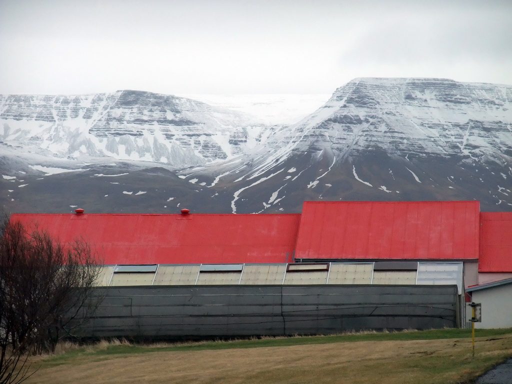
Thingvellir41 photos from Thingvellir 2013-02-28 Þingvellir (`Thing Fields`) is a place in Bláskógabyggð in southwestern Iceland, near the peninsula of Reykjanes and the Hengill volcanic area. Þingvellir is a site of historical, cultural, and geological importance and is one of the most popular tourist destinations in Iceland. It is the site of a rift valley that marks the crest of the Mid-Atlantic Ridge. It is also home to Þingvallavatn, the largest natural lake in Iceland. Parliament or Alþingi was established at Þingvellir in 930 and remained there until 1798. Þingvellir National Park was founded in 1930 to protect the remains of the parliament site and was later expanded to protect natural phenomena in the surrounding area. Þingvellir National Park was the first national park in Iceland and was decreed `a protected national shrine for all Icelanders, the perpetual property of the Icelandic nation under the preservation of parliament, never to be sold or mortgaged.` Tim and Miaomiao visited the site during their trip through Iceland in the winter of 2013. MORE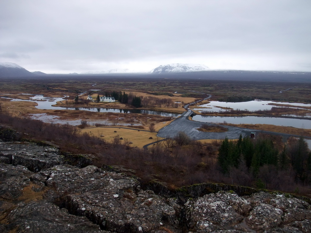
Thingvellir41 photos from Thingvellir 2013-02-28 Þingvellir (`Thing Fields`) is a place in Bláskógabyggð in southwestern Iceland, near the peninsula of Reykjanes and the Hengill volcanic area. Þingvellir is a site of historical, cultural, and geological importance and is one of the most popular tourist destinations in Iceland. It is the site of a rift valley that marks the crest of the Mid-Atlantic Ridge. It is also home to Þingvallavatn, the largest natural lake in Iceland. Parliament or Alþingi was established at Þingvellir in 930 and remained there until 1798. Þingvellir National Park was founded in 1930 to protect the remains of the parliament site and was later expanded to protect natural phenomena in the surrounding area. Þingvellir National Park was the first national park in Iceland and was decreed `a protected national shrine for all Icelanders, the perpetual property of the Icelandic nation under the preservation of parliament, never to be sold or mortgaged.` Tim and Miaomiao visited the site during their trip through Iceland in the winter of 2013. MORE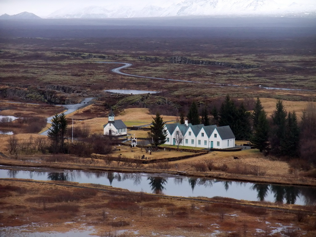
Thingvellir41 photos from Thingvellir 2013-02-28 Þingvellir (`Thing Fields`) is a place in Bláskógabyggð in southwestern Iceland, near the peninsula of Reykjanes and the Hengill volcanic area. Þingvellir is a site of historical, cultural, and geological importance and is one of the most popular tourist destinations in Iceland. It is the site of a rift valley that marks the crest of the Mid-Atlantic Ridge. It is also home to Þingvallavatn, the largest natural lake in Iceland. Parliament or Alþingi was established at Þingvellir in 930 and remained there until 1798. Þingvellir National Park was founded in 1930 to protect the remains of the parliament site and was later expanded to protect natural phenomena in the surrounding area. Þingvellir National Park was the first national park in Iceland and was decreed `a protected national shrine for all Icelanders, the perpetual property of the Icelandic nation under the preservation of parliament, never to be sold or mortgaged.` Tim and Miaomiao visited the site during their trip through Iceland in the winter of 2013. MORE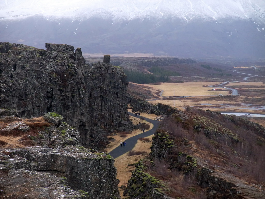
Thingvellir41 photos from Thingvellir 2013-02-28 Þingvellir (`Thing Fields`) is a place in Bláskógabyggð in southwestern Iceland, near the peninsula of Reykjanes and the Hengill volcanic area. Þingvellir is a site of historical, cultural, and geological importance and is one of the most popular tourist destinations in Iceland. It is the site of a rift valley that marks the crest of the Mid-Atlantic Ridge. It is also home to Þingvallavatn, the largest natural lake in Iceland. Parliament or Alþingi was established at Þingvellir in 930 and remained there until 1798. Þingvellir National Park was founded in 1930 to protect the remains of the parliament site and was later expanded to protect natural phenomena in the surrounding area. Þingvellir National Park was the first national park in Iceland and was decreed `a protected national shrine for all Icelanders, the perpetual property of the Icelandic nation under the preservation of parliament, never to be sold or mortgaged.` Tim and Miaomiao visited the site during their trip through Iceland in the winter of 2013. MORE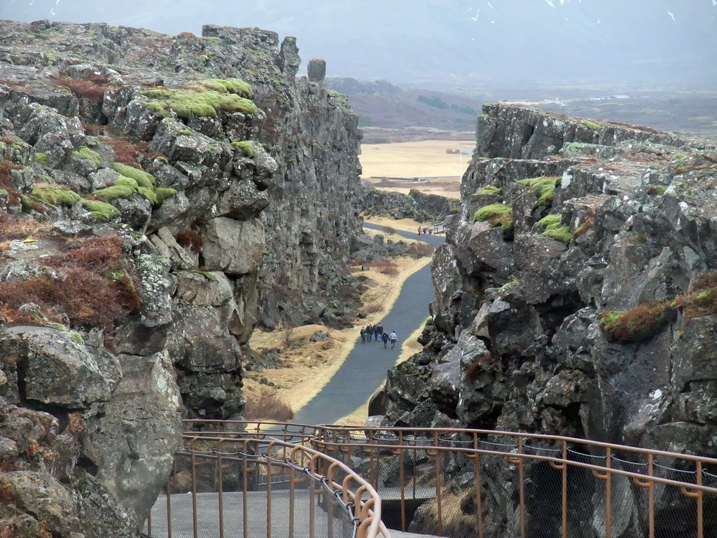
Thingvellir41 photos from Thingvellir 2013-02-28 Þingvellir (`Thing Fields`) is a place in Bláskógabyggð in southwestern Iceland, near the peninsula of Reykjanes and the Hengill volcanic area. Þingvellir is a site of historical, cultural, and geological importance and is one of the most popular tourist destinations in Iceland. It is the site of a rift valley that marks the crest of the Mid-Atlantic Ridge. It is also home to Þingvallavatn, the largest natural lake in Iceland. Parliament or Alþingi was established at Þingvellir in 930 and remained there until 1798. Þingvellir National Park was founded in 1930 to protect the remains of the parliament site and was later expanded to protect natural phenomena in the surrounding area. Þingvellir National Park was the first national park in Iceland and was decreed `a protected national shrine for all Icelanders, the perpetual property of the Icelandic nation under the preservation of parliament, never to be sold or mortgaged.` Tim and Miaomiao visited the site during their trip through Iceland in the winter of 2013. MORE |

| |
|
path parking alongside ingvallakirkja island scale stones esja lfarsfell point region its ingvallavatn fault park hills lake national mountains road ingvellir centre model viewing almannagj ingvallavegur surroundings mosfellsb northeast outside geysir place west buildings side gberg through mount reykjavik apartment laugarvatn miaomiao north church with map visitor information view gjabakkavegur |